


Only logged in customers who have purchased this product may leave a review.
Products
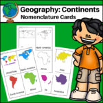
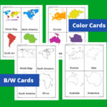
Continents – World Geography Nomenclature Cards
$2.00
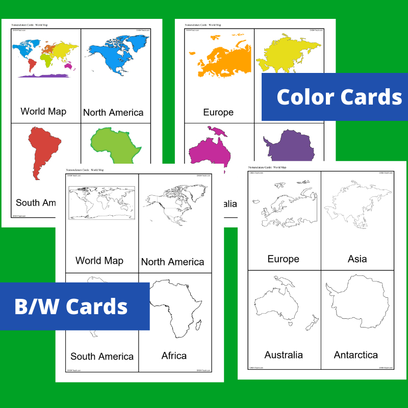
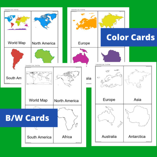
This resource, Continents – World Geography Nomenclature Cards, will help your students learn the shape of each of the seven continents!
Includes 2 sets:
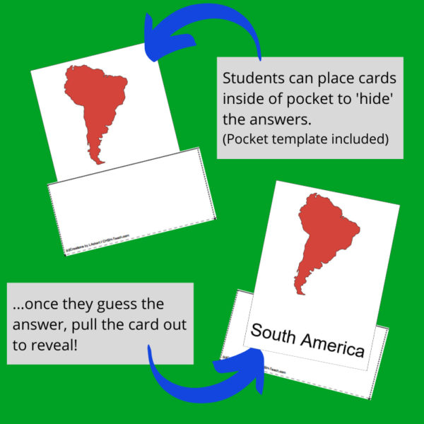
– Color set for a Social Studies / Geography Center or for use on an interactive bulletin board
– B/W set to give each student there own ‘flash’ nomenclature cards
Related products
-
 $5.00Buy Now
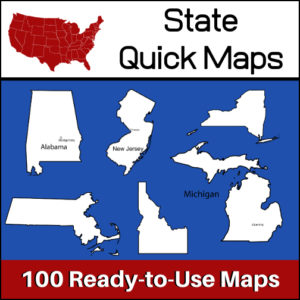
100 U.S. State outline maps – 2 maps for each state on one page:
- – Completely blank outline map
- – An outline with the state name and capital
Maps can be used for projects, bulletin boards, lesson plans and presentations.
Non-commercial use only. -
 $6.00Buy Now
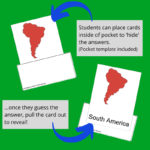
This resource has been designed so that students can use to report on any country throughout the world! Students can use this resource time and time again and create an entire collection of country lapbooks. A large variety of templates are included (see description below) as well as instructions on how to construct a lapbook, teacher directed assignments page and evaluation rubric.
Click here for a flipbook preview!
-
 $3.50Buy Now
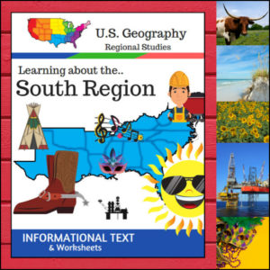
This Regions of the U.S. Geography resource is centered on the South Region and contains textbook style informational text and related student worksheets with answer keys. Students will enjoy learning about this region studying the categories of Land and Water, Climate, Products and Natural Resources, Landmarks, Culture and Food. The informational text worksheets begin with an anticipation activity section followed by questions that students will answer about each category. The last is a fun ‘unscramble’ the state names worksheet. (Pages: 15)
Because the United States can be divided up into different regions, I’ve designed this resource to follow the regions as defined by the U.S. Census Bureau. The resource shows the states in the Midwest as being Alabama, Arkansas, Delaware, Florida, Georgia, Kentucky, Louisiana, Maryland, Mississippi, North Carolina, Oklahoma, South Carolina, Tennessee, Texas, Virginia and West Virginia
⭐ This product is included in a $$$ SAVING BUNDLE: Regions of the U.S.A. | Geography Bundle
-
 $8.00Buy Now
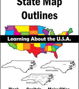
150 maps included in this download!
Each state has 3 pages / maps:
* Outline of the state
* Map showing the capital
* Map showing the major cities
&url=https://myteachinglibrary.com/product/u-s-state-map-outlines-usa-geography/&media=https://myteachinglibrary.com/wp-content/uploads/2019/08/wy-459-f.jpg)
Reviews
There are no reviews yet.