Category: Geography
Showing 1–20 of 21 resultsSorted by latest
-
 $50.00Add to Cart
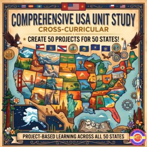
You get 50 projects for $1 each as you take your students on an unforgettable journey from sea to shining sea! 🗽
Are you looking for a way to teach U.S. Geography and History that actually sticks? Tired of dry textbooks and repetitive worksheets? The Comprehensive USA Unit Study is an interactive, cross-curricular, student-centered resource designed to transform your homeschool or classroom into a hub of discovery.
This isn’t just a packet of papers—it’s a complete investigative framework. Whether you are teaching a single second-grader, a multi-age group of middle schoolers or wanting a family style unit, this resource scales to fit your needs. Students will read, research, and report their way through all 50 states, producing 50 unique and beautiful projects along the way!
📝 What’s Inside This Massive Resource?
My Teaching Library has included everything you need to plan, execute, and evaluate a high-quality cross-curricular unit:
1. The Research & Reference Core 📚
-
A Comprehensive 50-State Guide: Detailed facts for every state, including history, capitals, nicknames, mottos, symbols, major industries, and landmarks.
-
Read Across America Literary Journey: Curated book suggestions for every single state to integrate literature into your lessons combining reading and geography!
-
Research Recording Pages: Structured notebooking pages to guide students through the investigative process.
2. Student Notebooking & Reporting ✍️
-
Wide Variety of Report Pages: From the history of the founding and lawmaking processes to local government, tourism, and economy.
-
State Symbol Spotlights: Dedicated pages for state birds, flowers, mammals, insects, rocks/minerals, and more.
-
Compare & Contrast: Use the included Venn diagrams to help students find similarities and differences between different states.
3. Maps, Flags, and Visual Aids 🎨
-
Full-Page Maps: Includes Color and B&W maps of the U.S., regional divisions, and individual state maps (blank, with capitals, and with major cities).
-
Artistic Templates: Full-page B&W images of all 50 state flags, flowers, and birds—perfect for coloring and report covers.
-
Lined State Maps: Unique templates for students to write summaries directly within the state borders, how fun!
4. Teacher Planning & Active Learning 🍎
-
“How-To” Planning Pages: Includes teacher assignment guides, a comprehensive supply list, and an evaluation rubric for easy grading.
-
Organizational Tools: Student cover pages, Table of Contents, and a reusable K-W-L chart.
-
Active Learning Games: Suggested games to keep students engaged and help them memorize state facts through play.
-
State Capital Bookmarks: A fun, functional way for students to use throughout the unit.
✨ Why You’ll Love It:
-
Multi-Age & Multi-Ability: Perfect for families homeschooling multiple children or teachers with diverse learners. Simply choose the reporting depth that fits the student’s level.
-
Cross-Curricular: Seamlessly blends Geography, History, Language Arts, Art, and Civics.
-
Student-Led: Empowers students to take ownership of their research and creativity.
-
Flexible: Use it as a full-year curriculum, a summer enrichment program, or a “State of the Week” supplement.
🚀 Ready to start your cross-country adventure?
Give your students the tools to become experts on the United States. From the rocky coasts of Maine to the tropical shores of Hawaii, the Comprehensive USA Unit Study makes history and geography come alive while seamlessly intertwining language arts, art, and civics!
Add to Cart, Download & Start Exploring & Creating Today! 🛒
-
-
Sale!Original price was: $6.00.$5.00Current price is: $5.00.Add to Cart
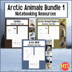
This Arctic Animal Notebooking Bundle includes three products: Arctic Wolf, the Arctic Ground Squirrel and the Caribou. Each individual resource can be used when studying the arctic habitat, tundra animals or as a cross-curricular unit that will have students reading, writing, completing map work (geography) and learning about the lives of these animals (science).
-
$3.00Add to Cart
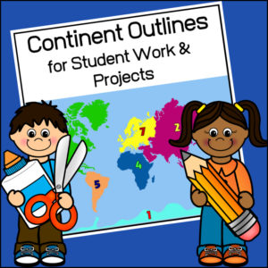
This resource, Continent Outlines for Student Work and Projects, contains 14 pages of continent outlines (7 labeled, 7 unlabeled). This is not clipart but ready to use outlines, just print and give to students to use however they need to!
-
$8.00Add to Cart
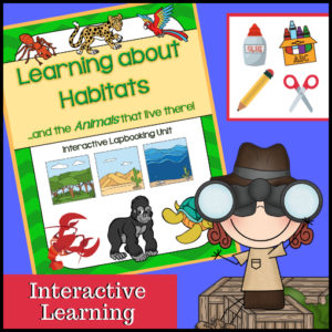
This unit on habitats and the animals that live in each is an interactive learning unit that allows students to be hands-on and create a beautiful project be the completion of the study! Use as a mini-course, in a Science center or in conjunction with another habitat study.
Use the complete unit (or) use only parts of it. Designed for 2nd-4th grades so it has been designed to work well with multiple ages/grades.
Includes:
– Instructions
– Informational text (Definition of habitat plus information on these 8 different habitats: desert, forest, ocean, arctic, wetlands, grasslands, rainforest and jungle)
– Suggested book recommendations for further study
– Project pieces (cover pages, vocabulary, definitions, habitat cards, mini-book, habitat flapbooks, habitat pockets to insert included animal cards, basic needs spinning template, favorite animal templates plus clip art)Comes in both black/white pages as well as color (so you decide if you want to print using color ink or not as well as if you want your students to color or not).
See included habitats and animals in description below.
-
$3.00Add to Cart
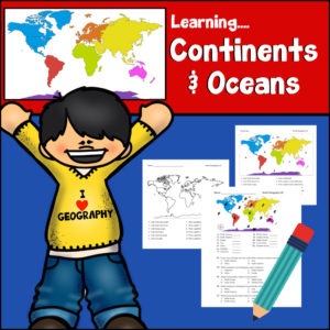
This resource provides a hands-on, interactive way for students to master world geography by identifying and learning about the world’s seven continents and five oceans. Designed as a print-n-go resource, it includes:
-
Skill-Building Exercises: Engaging activities that prompt students to label, color-code, and identify geographic features, reinforcing their spatial awareness of the globe.
-
Assessment Tools: A structured answer key is provided, making it an excellent resource for self-checking or quick grading.
-
Visual Learning: The straightforward layout encourages students to engage with maps directly, helping them develop a solid foundation in physical geography.
Whether used as a primary instructional tool or as a supplemental activity for reinforcing map-reading skills, this resource is a helpful asset for building geographic literacy in early to middle elementary grade levels.
Specifics:
- Worksheets #1-5 – Students will be given a coded world map and asked to (1) identify each continent and ocean; (2) answer directional questions such as “Which ocean touches the Africa’s western border?”
- Worksheets #6-7 – Students will need to write out the names of each continent and ocean (#6 has a word bank; #7 does not)
- Worksheet #8 – Students will follow directions to color each continent a particular color and how to label each ocean.
- Answer Keys
Print and Go – Ready to use!
Place in your cart and download today!
-
-
 $8.00Add to Cart
150 maps included in this download!
Each state has 3 pages / maps:
* Outline of the state
* Map showing the capital
* Map showing the major cities -
$2.50Add to Cart
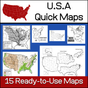
15 ready-to-use maps of the United States. Use for class projects, to create lessons or presentations.
Non-commercial use only.Includes:
– 2 maps showing the US within North America
– US maps (with states names and unnamed)
– US regional maps (with states names and unnamed)
– US east of the Mississippi (with states names and unnamed)
– US west of the Mississippi (with states names and unnamed)
– Physical Maps of the US (color and b/w)
– The Mississippi River with tributaries (states named) -
$1.50Add to Cart
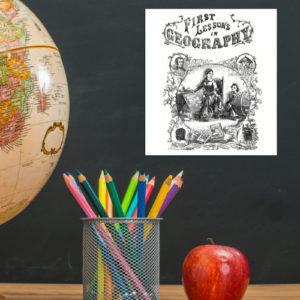
This is a downloadable copy of the book. (74 pages)
About the book: This book was written in 1856 is written in a question – answer format:
Q. What is Geography?
A. A description of the Earth’s surfact
Q. What is the Earth
A. The planet or body on which we live.
Q. What is a Continent?
A. The largest division of land.Because it was written in the mid 19th century, all of the maps are outdated…However, this can lend itself to great teaching lessons! Compare and contrast the old with the new. Research what events in history led up to the changes from then to now, etc.!
-
$1.25Add to Cart
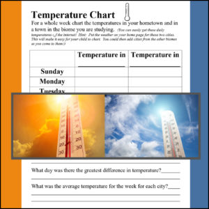
A biome is a large geographical area that contains distinct plant and animal groups which are adapted to live in that environment. There can be many different habitats in a biome. Some major biomes are tundra, taiga, grasslands, deciduous forest, fresh water, desert, alpine, rainforest and ocean. When studying a specific biome, use this temperature comparison chart to record the temperature in the student’s hometown and the biome of study for a week! (Use again and again with each biome studied)
Science meets Geography
-
$3.00Add to Cart
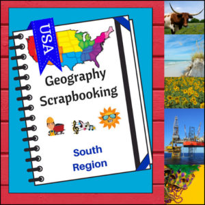
Turn your geography lessons into a creative travel adventure! As your students explore land of hospitality, diverse landscapes, and rich history of the South region, these scrapbooking pages offer a dynamic way for them to document their “journey.” Instead of just memorizing facts, students become curators of their own learning, capturing the essence of the states from West Virginia down to Florida and over to Texas.
This 5-page set is designed to be the perfect companion to your regional studies, allowing students to blend artistic expression with factual writing.
🧠 The “How” and “Why” (Educational Benefits)
Why swap traditional worksheets for scrapbooking? It’s all about active synthesis:
- Multisensory Engagement: By drawing or pasting pictures and writing short descriptions, students engage multiple areas of the brain, leading to significantly higher information retention. 🎨
- Critical Thinking & Opinion: The “Personal Opinion” section moves beyond rote memorization, asking students to evaluate information and decide what interests them most—a key skill in developing independent learners. 💭
- Comprehensive Coverage: These pages guide students through the “Big Six” of geography: Climate, Landforms, Water, Natural Resources, Landmarks, and Culture. 🏔️🌊
- Ownership of Learning: Creating a scrapbook gives students a sense of pride and ownership. It’s no longer just a school assignment; it’s an artifact of their hard work. 📖
🛠️ Creative Ways to Use These Pages
- The “Travel Journal” Project: Have students “visit” the South virtually. Use these pages as their daily log to record what they “saw” each day. ✈️
- State Fair Displays: If students are doing a deep dive into specific states, use these pages as the centerpiece for a poster board or display table.
- Geography Portfolios: Add these pages to a year-long geography binder. By the end of the year, students will have a complete “Travel Guide to the USA.” 📁
- Collaborative Posters: Print the pages at a larger scale and have small groups (or family) work together to illustrate and describe a specific aspect of the south (like “Culture and Food”). 🍕
📝 What’s Included:
- 5 Detailed Scrapbooking Pages: Focused on the Southern states.
- Guided Categories: Sections for Climate, Landforms, Water, Natural Resources, Landmarks, and Culture.
- Map Skills: Locating the states within the region.
- Personal Reflection: Space for students to share where they would most like to visit.
Pro Tip: This set is designed to pair perfectly with My Teaching Library’s Regions of the U.S. – South Region | Informational Text and Worksheets for a complete, no-prep curriculum solution!
🚀 Start Your South Adventure!
Transform your geography unit from dry facts into a vivid discovery! Download the South Scrapbooking Pages today and give your students the creative space to show off what they know!✨
Use as a stand-alone product or use with My Teaching Library’s Regions of the U.S. – South Region – Informational Text and Worksheets
⭐ This product is included in a $$$ SAVING BUNDLE: Regions of the U.S.A. | Geography Bundle
-
$2.00Add to Cart
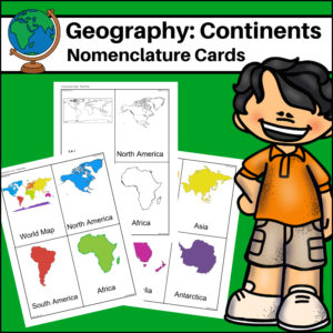
This resource, Continents – World Geography Nomenclature Cards, will help your students learn the shape of each of the seven continents!
Includes 2 sets:
– Color set for a Social Studies / Geography Center or for use on an interactive bulletin board
– B/W set to give each student there own ‘flash’ nomenclature cards -
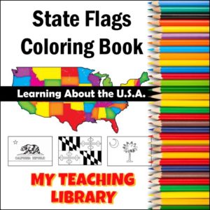
$5.00Add to Cart
This resource combines geography, state studies and art giving students a coloring page for the flag of each U.S. state! Each page has a large state flag to color + the state name. Whether you are studying each state or simply want to provide some fun but educational activities to your classroom, students will enjoy this resource.
** This resource includes the NEW Mississippi state flag **
-
$6.75Add to Cart
This Country Studies Lapbook is a versatile, hands-on resource designed to help students organize and present their research on any nation. It provides structured, interactive templates that transform geography lessons into engaging, personalized learning projects.
Key Features
-
Comprehensive Templates: The lapbook includes a variety of custom-designed “foldables” that allow students to display key information, including:
-
Geographic Basics: Templates for mapping borders, rivers, mountain ranges, seas, lakes, and oceans.
-
Country Profile: Dedicated spaces for identifying the capital city and neighboring countries.
-
Cultural & Economic Details: Creative components for tracking natural resources, agriculture, religion, and historical event timelines.
-
Interactive Elements: Features like a “money fan” and a time-difference flap book to add tactile interest to the learning process.
-
-
Flexible Application: Designed for use in classrooms, co-ops, or homeschool settings, this resource allows educators to adapt the study of world geography to fit individual student interests and grade levels.
-
Organized Presentation: By consolidating research into a lapbook format, students develop strong organizational and research skills while creating a portfolio of their geographic learning.
This resource is an ideal tool for fostering “child-centered learning,” enabling students to research, document, and showcase their understanding of global cultures and geography through active, project-based creation.
Click here for a flipbook preview!
-
-
$1.75Add to Cart
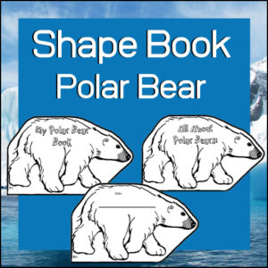
Students love to create and this resource, Shape Book – Polar Bears, will give them a fun template to create! Whether they are publishing a story, a poem or a brief report about the arctic, arctic animals or polar bears, their work will be extra special to them using these polar bear templates.
See description below for suggestions on how to use.
-
$2.00Add to Cart
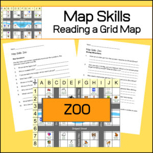
Students will practice reading a grid map and a map key with these zoo themed worksheets. Students will be given a grid map of a zoo and asked several questions requiring them read and navigate throughout the map. There are also two additional activities to extend learning (through writing and creative design). Answer Key included.
-
$5.00Add to Cart
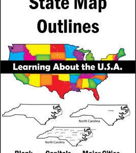
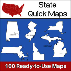
100 U.S. State outline maps – 2 maps for each state on one page:
- – Completely blank outline map
- – An outline with the state name and capital
Maps can be used for projects, bulletin boards, lesson plans and presentations.
Non-commercial use only. -
$3.00Add to Cart
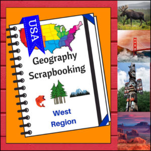
🏔️ Capture the spirit of the frontier and the beauty of the Pacific Coast with this hands-on, interactive geography resource! As your students explore the vast and varied Western region, these scrapbooking and notebooking pages provide the perfect canvas for them to document their discoveries. From the Rocky Mountains to the Hawaiian islands, students become active explorers of the American West!
This 5-page set is designed to be a flexible, creative companion to your geography curriculum, allowing students to blend factual research with their own artistic flair.
🧠 The “How” and “Why” (Educational Benefits)
Why incorporate scrapbooking into your geography lessons? It’s all about immersive learning:
- Visual & Spatial Memory: By drawing or pasting images of the West’s iconic landscapes, students create strong mental maps of diverse environments like the Mojave Desert and the Alaskan tundra. 🎨
- Summarization Skills: Writing “short sentences” about complex topics like natural resources or culture helps students practice the essential skill of synthesizing information. ✍️
- Personal Connection: The “Place I’d Like to Visit” section encourages students to connect personally with their studies, turning abstract map locations into real-life dream destinations. 💭
- Comprehensive Regional Look: These pages ensure students explore the region’s identity through six key lenses: Climate, Landforms, Water, Natural Resources, Landmarks, and Culture. 🌋🌲
🛠️ Creative Ways to Use These Pages
- Digital & Physical Integration: Have students use tablets to find authentic photos of the Grand Canyon or Yellowstone to print and paste into their scrapbooks. 📸
- A “Western Expedition” Journal: Use these pages as a project where students “travel” to a new state in the West each day, filling in their findings as they go. 🗺️
- Alternative Assessment: Use the completed scrapbooks as a portfolio piece to show mastery of the West region in a way that’s much more engaging than a traditional test.
- Interactive Notebooking: These pages fit perfectly into a social studies binder or notebook, creating a beautiful keepsake of the school year’s geographic journey. 📁
📝 What’s Included:
- 5 High-Quality Scrapbooking/Notebooking Pages: Specifically tailored to the West region.
- Guided Research Prompts: Sections for drawing, pasting, and writing about the region’s geography and lifestyle.
- State Identification: A dedicated area for naming the states within the region.
- Student Reflection: Space for students to share their personal travel interests.
Pro Tip: For the ultimate learning experience, pair these pages with Regions of the U.S. – West Region | Informational Text and Worksheets. Students can use the facts they learn there to fill their scrapbooks with expert knowledge!
🚀 Head West with Your Students! Turn your geography unit into a creative adventure! Download the West Scrapbooking Pages today and watch your students bring the wonder of the Western United States to life on the page!
⭐ This product is included in a $$$ SAVING BUNDLE: Regions of the U.S.A. | Geography Bundle
-
$2.00Add to Cart
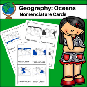
This resource, Oceans – World Geography Nomenclature Cards, will help your students learn the names and locations of the world’s 5 major oceans: Arctic, Atlantic, Pacific, Indian and Southern.
-
$1.00Add to Cart
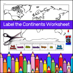
Whether you are looking for a worksheet to reinforce student knowledge on the location of continents or you are ready to assess their knowledge, this resource will do the trick!
Students will first color each continent and then cut and glue the labels where they belong.
-
$3.75Add to Cart
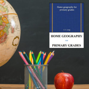
This book, Home Geography for Primary Grades by C. C. Long, Ph.D., is an educational text designed to introduce foundational geographical concepts to young children through direct observation and experience. This classic (original is out-of-print) text may be found on Amazon at a higher price than My Teaching Library is offering it to you.
Core Educational Philosophy
The book is built on the premise that geography is best understood in two stages:
- Direct Observation (The Home): Students begin by studying the immediate environment “at their doors,” such as local streams, slopes, and valleys, using these to build a basis for understanding the wider world.
- Imaginative Expansion (The World): Once elementary ideas are anchored in personal experience, the book teaches students to use their imagination to construct mental pictures of distant, unseen geographical features.
Key Learning Features
- Conversational Tone: Lessons are structured as natural, conversational dialogues rather than dense, “science-heavy” lectures, aimed at stimulating interest and active thought rather than just rote memorization.
- Active Learning & Expression: The book emphasizes that knowledge should be tested through expression. Students are encouraged to:
- Model landscapes using sand or clay.
- Draw what they observe to learn how to “see well”.
- Describe findings orally and in writing.
- Conduct independent “searching” to report results back to the class.
- Practical Application: The text uses familiar, concrete examples to teach abstract concepts. For example, it utilizes a kettle to explain vapor and a boy’s drawing of his house to introduce the difference between a picture and a “plan” (or map) .
Structure & Content
The curriculum guides students through a logical progression of topics:
- Fundamentals of Direction and Distance: Lessons cover using the sun, stars, and compass to find direction and tools for measuring distance.
- Landforms and Systems: Detailed lessons explore plains, deserts, oases, hills, mountains, valleys, and the life cycle of rivers.
- Environmental & Human Geography: The book connects natural phenomena (rain, snow, wind) to human life, covering agriculture (vegetables, grains) , resources (forest trees, minerals, metals, and various human occupations.
- Illustrations: The text is heavily supported by numerous instructional illustrations (black and white), helping students visualize concepts ranging from celestial bodies and landscapes to agricultural practices and industrial settings.
Home Geography for Primary Grades serves as a practical, hands-on resource that encourages children to become active observers of their world, bridging the gap between their local surroundings and the broader geography of the earth.

&url=https://myteachinglibrary.com/product/u-s-state-map-outlines-usa-geography/&media=https://myteachinglibrary.com/wp-content/uploads/2019/08/wy-459-f.jpg)