
Tag: 6th grade
Showing all 10 resultsSorted by latest
-
 $5.75Add to Cart
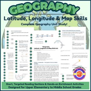
Take the Mystery Out of Map Coordinates!
Are your students struggling to understand how latitude and longitude work? Do they get confused between parallels and meridians, or mix up the coordinate order?
This comprehensive, ready-to-print geography unit provides an all-in-one solution for teaching global coordinates, navigational history, map grids, and climate zones! Designed specifically for 5th-8th grade level learners, this unit breaks down complex spatial concepts into clear, engaging, and scannable lessons accompanied by custom visual reference diagrams for every section.
📦 What’s Included in This Downloadable PDF Packet?
This Student Workbook & Teacher Resource includes everything you need for a full geography unit:
Section 1: Introduction – The System of Lines on Globes and Maps
- Covers why mapmakers created grid systems, how 3D spherical globes differ from flattened 2D maps, and the difference between absolute location and relative location.
- Includes Figure 1.1: Globe Grid Intersection Diagram.
Section 2: Drawing the Earth Grid & Reference Points
- Defines nature’s fixed reference points (North & South Poles), the Equator (), Northern/Southern Hemispheres, Parallels, and Meridians.
- Includes Figure 2.1: Reference Points & Parallel Lines Diagram.
Section 3: Finding Latitude and Longitude Coordinates
- Breaks down the mandatory (Latitude, Longitude) ordering rule, memory tricks (“Latitude = Ladder”), degree ranges (– N/S vs – E/W), and subdivisions into minutes () and seconds () using real examples like the Statue of Liberty.
- Includes Figure 3.1: Map Coordinate Grid Plotting Diagram.
Section 4: Navigation at Sea and in the Air (The Sextant)
- Explores celestial navigation, how sailors use a sextant to measure Polaris (the North Star) for latitude, combining solar angles with Greenwich Mean Time (GMT) for longitude, and why the U.S. Navy still teaches sextants today.
- Includes Figure 4.1: Celestial Navigation Sightline & Horizon Angle Diagram.
Section 5: History Behind Discovery and Naming
- Chronicles key historical figures: Eratosthenes (calculating Earth’s size), Hipparchus ( circle grid), Ptolemy (Geographia and Latin roots latitudo / longitudo), and John Harrison’s invention of the marine chronometer to solve the “Longitude Problem”.
- Includes Figure 5.1: Historical Discovery Timeline Diagram.
Section 6: How the Prime Meridian Was Selected
- Details the International Meridian Conference of 1884 in Washington, D.C., why Greenwich, England was chosen, and how the Prime Meridian defines the Eastern and Western Hemispheres.
- Includes Figure 6.1: Prime Meridian & Eastern/Western Hemispheres Diagram.
Section 7: Special Lines of Latitude & Longitude and the Seasons
- Connects geography to Earth science! Explores the Equator, Tropics of Cancer & Capricorn (), Arctic/Antarctic Circles (), climate boundaries ( and parallels), and how Earth’s axial tilt creates the four seasons.
- Includes Figure 7.1: Earth Axial Tilt & Special Lines Diagram.
Section 8: Full Geography Unit Review Assessment
- A unit test featuring Multiple Choice (Part I), True/False (Part II), and Short Answer & Hemisphere Identification (Part III).
Complete Teacher Answer Keys
- Contains full, detailed answer keys for all section comprehension questions as well as the complete review assessment test.
🧠 Core Social Studies & Map Skills Covered
- Spatial Thinking & Coordinate Plotting: Correctly reading, writing, and pinpointing coordinates in format.
- Absolute vs. Relative Location: Differentiating between permanent mathematical coordinates and landmark-based descriptions.
- Hemispheric Geography: Categorizing global positions across Northern, Southern, Eastern, and Western Hemispheres.
- Historical Inquiry & Technology: Understanding how human innovation (from Greek astronomy to 18th-century clocks and sextants) solved global navigation challenges.
- Integrated Earth Science: Analyzing how Earth’s rotational axis tilt () and solar ray directness create distinct seasonal and climate zones along specific parallels.
💡 Why You’ll Love This Unit
- Visual Learning Centered: Every lesson includes a dedicated reference diagram (globe grids, coordinate planes, horizon sightlines, timelines, axial tilts) so visual learners grasp abstract spatial concepts immediately.
- Built-in Student Worksheets: Every section ends with 4 short-answer comprehension questions that work as exit tickets, daily quizzes, or notebook prompts.
- Zero Prep Required: Open, print, and teach!
🎯 How to Use Suggestions
- 2-Week Unit Study: Teach 1 section per day. Have students read the section text, analyze the visual figure, and complete the 4 comprehension questions. Conclude the second week with the Section 8 Review Assessment.
- Independent Unit: Perfect for self-paced independent learning. Multi-grade classrooms or families can work through the readings together and use the visual diagrams to lead discussions.
🛒 Ready to Master Geography & Navigation?
Equip your students with lifetime map-reading confidence, historical context, and spatial reasoning skills!
Includes High-Value Components:-
Structured Content: 7 full instructional reading sections covering core concept skills, history, and real-world application (e.g., sextant navigation, Greenwich conference).
-
Built-in Assessment: Section-by-section comprehension questions plus a full unit review test.
-
Convenience: Complete answer keys for all sections and tests.
-
STEM / Hands-On Enrichment: Multi-sensory lab activities (cardboard sextant lab, edible orange-peel map projection, living history journal entry)
Get yours today!
-
$4.00Add to Cart
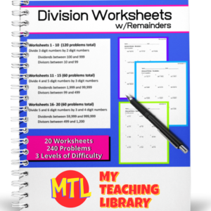
This advanced division workbook includes 20 student worksheets with answer keys. There are three levels of difficulty, all quotients will include remainders and there are a total of 240 problems. This workbook as been designed for 5th, 6th and 7th grades.
Sections include:
Worksheets 1-10 – Divide 3 digit numbers by 2 digit numbers (120 problems)
Worksheets 11-15 – Divide 4 and 5 digit numbers by 3 digit numbers (60 problems)
Worksheets 16-20 – Divide 5 and 6 digit numbers by 3 and 4 digit numbers (60 problems) -
$2.50Add to Cart
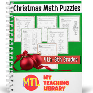
Six worksheets with challenging math puzzles for 4th, 5th and 6th grades students to improve critical thinking and math skills during December leading up to Christmas or to use during the holiday break! Answer Keys provided!
Please read description below for details of the puzzles.
-
$3.50Add to Cart
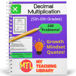
This resource is designed to give students the practice the need to become proficient at multiplying decimals. There are three levels, 15 worksheets (16 problems each) and answer keys. That’s 240 problems – EACH WORKSHEET includes a different growth mindset quote!
(See description below for more details) -
$9.99Add to Cart
Teacher’s Guide for Language Arts 3 (suggested 8th Grade use)
-
$15.00Add to Cart
Teacher’s Guide for Language Arts 1 (suggested 6th Grade use)
-
$15.00Add to Cart
Teacher’s Guide for Language Arts 2 (suggested 7th Grade use)
-
$9.99Add to Cart
Student Edition for Language Arts 3
(Suggested for 8th Grade)This is a large 556 page resource – 1 complete year of Language Arts curriculum.
Teacher Edition available here!This is the 2nd in a series of middle school Language Arts curriculum. They all are very similar in design and only builds, covering the core skills and concepts that should be taught each year. We offer a short preview of Language Arts 1 and when viewing, you’ll be able to see what type of curriculum you can expect in Language Arts 3.
-
$15.00Add to Cart
Student Edition for Language Arts 1
(Suggested for 6th Grade)This is a large 500 page resource – 1 complete year of Language Arts curriculum!
Watch preview video here. -
$15.00Add to Cart
Student Edition for Language Arts 2
(Suggested for 7th Grade)This is a large 471 page resource – 1 complete year of Language Arts curriculum.
Teacher Edition available here!This is the 2nd in a series of middle school Language Arts curriculum. They all are very similar in design and only builds, covering the core skills and concepts that should be taught each year. We offer a short preview of Language Arts 1 and when viewing, you’ll be able to see what type of curriculum you can expect in Language Arts 2.