Category: Maps
Showing all 10 resultsSorted by latest
-
 $1.50Add to Cart
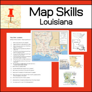
Learning to read different types of maps is a vital skill for students to learn and practice. With this resource, students will be given several maps and questions to answer using the maps. Maps and questions all center around the state of Louisiana.
-
$3.00Add to Cart
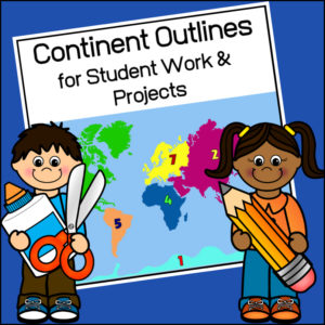
This resource, Continent Outlines for Student Work and Projects, contains 14 pages of continent outlines (7 labeled, 7 unlabeled). This is not clipart but ready to use outlines, just print and give to students to use however they need to!
-
 $8.00Add to Cart
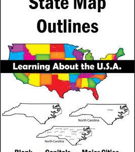
150 maps included in this download!
Each state has 3 pages / maps:
* Outline of the state
* Map showing the capital
* Map showing the major cities -
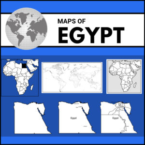
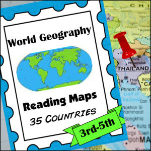
$8.00Add to CartHelp students master an important life skill, map reading, with this geography resource! It includes maps of 35 countries from around the world and students will practice identifying direction, using a scale of miles/km, reading & using a map key, finding places and determining specific information from given information, calculate distance and more!
This product is designed for 3th-5th grades but can be a good edition for 6th-8th graders who need extra practicing reading maps! -
$6.00Add to Cart
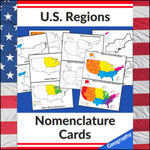
Mastering the map has never been more visual! This set of 20 professional nomenclature cards is the perfect foundational tool for any U.S. geography unit. Based on the 4 regions as defined by the U.S. Census Bureau (Northeast, Midwest, South, and West), these cards provide a clear, structured way for students to visualize how the United States is organized.
From full-color coded keys to black-and-white standalone regional maps, this versatile set helps students transition from “the big picture” to specific regional details with ease.
🧠 The “How” and “Why” (Educational Benefits)
Why use nomenclature cards for geography? It’s all about spatial recognition and scaffolded learning:
- Visual Discrimination: By seeing a region highlighted in color against a grayscale map of the whole U.S., students naturally learn exactly where that region sits in relation to the rest of the country. 📍
- Scaffolded Difficulty: Start with the cards that include state names for guided learning, then transition to the name-free cards to challenge their memory. 🎓
- Standards-Aligned: Because these follow the U.S. Census Bureau divisions, you can be confident your students are learning the most widely accepted geographic classifications used in social studies. ✅
- Versatility: The mix of color and black-and-white versions allows for high-impact visual aids or budget-friendly, student-ready worksheets.
🛠️ Ways to Use These
- Geography Centers: Laminate the color cards and use them as a “match the region” game or sorting activity. 🧩
- Interactive Notebooks: Print the black-and-white versions for students to color in, label, and glue into their social studies journals. 📓
- Flashcard Drills: Use the cards to quiz students on state locations within specific regions (e.g., “Which states are in the Midwest?”). ⚡
- Display: Create a stunning “Geography Wall” using the full-color coded keys as a reference point for students during independent work. 🖼️
🚀 Help Your Students Find Their Way!
Equip your geography explorers with the visual tools they need to master U.S. Geography. Add these US Regions Nomenclature Cards to your teaching toolkit today and watch their map-reading confidence soar! 🌟
UPGRADE and get this BUDNLE: Regions of the U.S.A. | Geography Bundle
-
$2.50Add to Cart
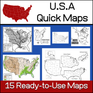
15 ready-to-use maps of the United States. Use for class projects, to create lessons or presentations.
Non-commercial use only.Includes:
– 2 maps showing the US within North America
– US maps (with states names and unnamed)
– US regional maps (with states names and unnamed)
– US east of the Mississippi (with states names and unnamed)
– US west of the Mississippi (with states names and unnamed)
– Physical Maps of the US (color and b/w)
– The Mississippi River with tributaries (states named) -
$2.50Add to Cart
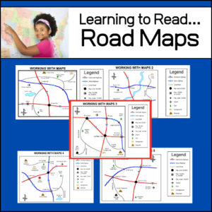
An important life skill is learning how to read maps! This resource provides 5 easy to read road maps. For each map, students will practice using the legend and answer 12-15 questions. Students will answer a total of 71 questions – Answer Keys provided.
-
$5.00Add to Cart
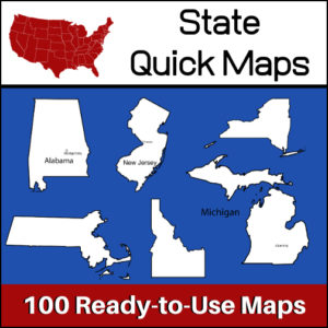
100 U.S. State outline maps – 2 maps for each state on one page:
- – Completely blank outline map
- – An outline with the state name and capital
Maps can be used for projects, bulletin boards, lesson plans and presentations.
Non-commercial use only. -
$3.00Add to Cart
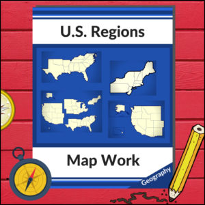
This resource will help your students learn more about U.S. Geography and the 4 main regions (as defined by the U.S. Census Bureau). Students will be working with maps of the entire United States as well as those of each region as they identify states, capitols, national parks, mountain ranges and points of interest! Great for any Social Studies class studying the U.S.A.!