Tag: unit studies
Showing all 5 resultsSorted by latest
-
 $50.00Add to Cart
You get 50 projects for $1 each as you take your students on an unforgettable journey from sea to shining sea! 🗽
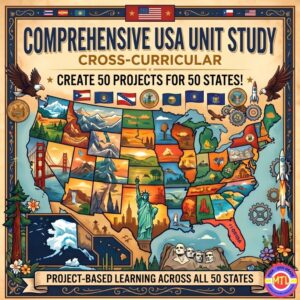
Are you looking for a way to teach U.S. Geography and History that actually sticks? Tired of dry textbooks and repetitive worksheets? The Comprehensive USA Unit Study is an interactive, cross-curricular, student-centered resource designed to transform your homeschool or classroom into a hub of discovery.
This isn’t just a packet of papers—it’s a complete investigative framework. Whether you are teaching a single second-grader, a multi-age group of middle schoolers or wanting a family style unit, this resource scales to fit your needs. Students will read, research, and report their way through all 50 states, producing 50 unique and beautiful projects along the way!
📝 What’s Inside This Massive Resource?
My Teaching Library has included everything you need to plan, execute, and evaluate a high-quality cross-curricular unit:
1. The Research & Reference Core 📚
-
A Comprehensive 50-State Guide: Detailed facts for every state, including history, capitals, nicknames, mottos, symbols, major industries, and landmarks.
-
Read Across America Literary Journey: Curated book suggestions for every single state to integrate literature into your lessons combining reading and geography!
-
Research Recording Pages: Structured notebooking pages to guide students through the investigative process.
2. Student Notebooking & Reporting ✍️
-
Wide Variety of Report Pages: From the history of the founding and lawmaking processes to local government, tourism, and economy.
-
State Symbol Spotlights: Dedicated pages for state birds, flowers, mammals, insects, rocks/minerals, and more.
-
Compare & Contrast: Use the included Venn diagrams to help students find similarities and differences between different states.
3. Maps, Flags, and Visual Aids 🎨
-
Full-Page Maps: Includes Color and B&W maps of the U.S., regional divisions, and individual state maps (blank, with capitals, and with major cities).
-
Artistic Templates: Full-page B&W images of all 50 state flags, flowers, and birds—perfect for coloring and report covers.
-
Lined State Maps: Unique templates for students to write summaries directly within the state borders, how fun!
4. Teacher Planning & Active Learning 🍎
-
“How-To” Planning Pages: Includes teacher assignment guides, a comprehensive supply list, and an evaluation rubric for easy grading.
-
Organizational Tools: Student cover pages, Table of Contents, and a reusable K-W-L chart.
-
Active Learning Games: Suggested games to keep students engaged and help them memorize state facts through play.
-
State Capital Bookmarks: A fun, functional way for students to use throughout the unit.
✨ Why You’ll Love It:
-
Multi-Age & Multi-Ability: Perfect for families homeschooling multiple children or teachers with diverse learners. Simply choose the reporting depth that fits the student’s level.
-
Cross-Curricular: Seamlessly blends Geography, History, Language Arts, Art, and Civics.
-
Student-Led: Empowers students to take ownership of their research and creativity.
-
Flexible: Use it as a full-year curriculum, a summer enrichment program, or a “State of the Week” supplement.
🚀 Ready to start your cross-country adventure?
Give your students the tools to become experts on the United States. From the rocky coasts of Maine to the tropical shores of Hawaii, the Comprehensive USA Unit Study makes history and geography come alive while seamlessly intertwining language arts, art, and civics!
Add to Cart, Download & Start Exploring & Creating Today! 🛒
-
-
$3.00Add to Cart
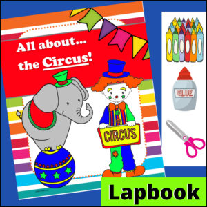
Students will love this engaging, hands-on lapbooking project as they learn a brief history about the circus starting in Europe and then coming to the United States. They’ll also learn the difference between the early circus and the circus of today!
-
$6.00Add to Cart
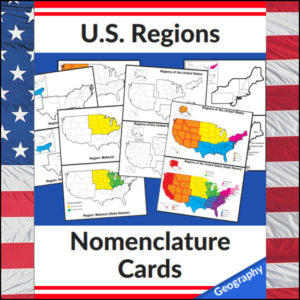
Mastering the map has never been more visual! This set of 20 professional nomenclature cards is the perfect foundational tool for any U.S. geography unit. Based on the 4 regions as defined by the U.S. Census Bureau (Northeast, Midwest, South, and West), these cards provide a clear, structured way for students to visualize how the United States is organized.
From full-color coded keys to black-and-white standalone regional maps, this versatile set helps students transition from “the big picture” to specific regional details with ease.
🧠 The “How” and “Why” (Educational Benefits)
Why use nomenclature cards for geography? It’s all about spatial recognition and scaffolded learning:
- Visual Discrimination: By seeing a region highlighted in color against a grayscale map of the whole U.S., students naturally learn exactly where that region sits in relation to the rest of the country. 📍
- Scaffolded Difficulty: Start with the cards that include state names for guided learning, then transition to the name-free cards to challenge their memory. 🎓
- Standards-Aligned: Because these follow the U.S. Census Bureau divisions, you can be confident your students are learning the most widely accepted geographic classifications used in social studies. ✅
- Versatility: The mix of color and black-and-white versions allows for high-impact visual aids or budget-friendly, student-ready worksheets.
🛠️ Ways to Use These
- Geography Centers: Laminate the color cards and use them as a “match the region” game or sorting activity. 🧩
- Interactive Notebooks: Print the black-and-white versions for students to color in, label, and glue into their social studies journals. 📓
- Flashcard Drills: Use the cards to quiz students on state locations within specific regions (e.g., “Which states are in the Midwest?”). ⚡
- Display: Create a stunning “Geography Wall” using the full-color coded keys as a reference point for students during independent work. 🖼️
🚀 Help Your Students Find Their Way!
Equip your geography explorers with the visual tools they need to master U.S. Geography. Add these US Regions Nomenclature Cards to your teaching toolkit today and watch their map-reading confidence soar! 🌟
UPGRADE and get this BUDNLE: Regions of the U.S.A. | Geography Bundle
-
$4.75Add to Cart
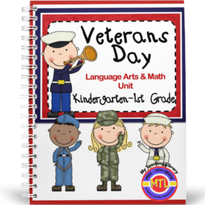
Celebrate the Veterans Day holiday throughout the month of November with this true cross-curricular resource! Your young learners will learn about the military branches of the United States and the why we should honor those who have served our country. They will practice a variety of Language Arts and Math Skills while they learn valuable Social Studies / History knowledge plus they will learn the song, Taps (Music).
-
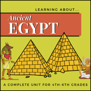
$4.99Add to CartThis unit on Ancient Egypt includes information on Egyptian history, time periods, beliefs around the afterlife, mummification, pharaohs, Book of the Dead, hieroglyphics, gods and goddesses and related vocabulary.
Work pages for students include reading comprehension, map work, timeline and diagram creation, research and summation, poetry, pyramid model building and more. Includes: Interactive Notebooking Project!