


Description
Vocabulary covered in the unit:
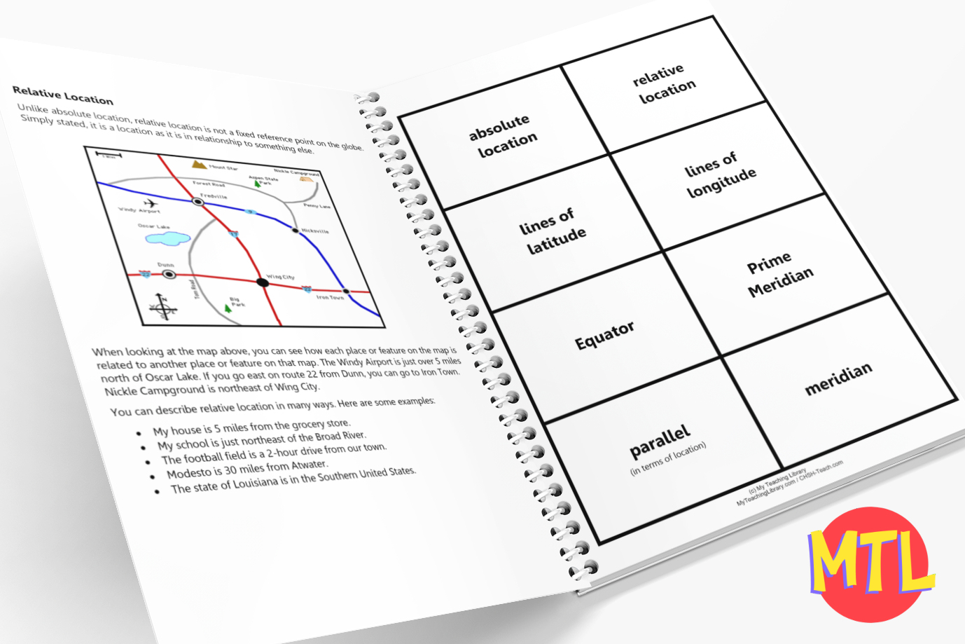
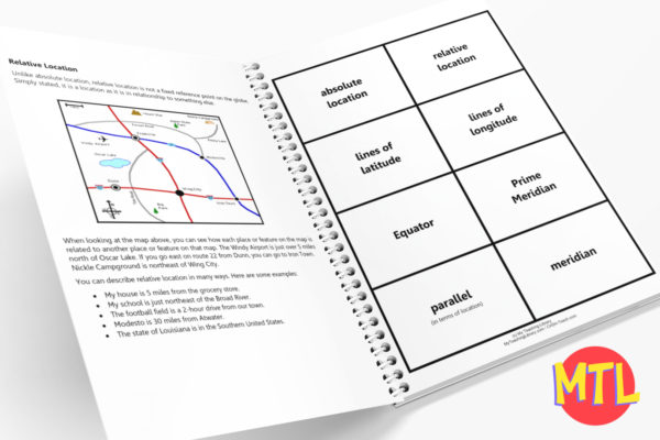
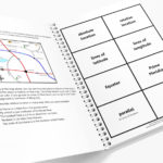
- absolute location
- relative location
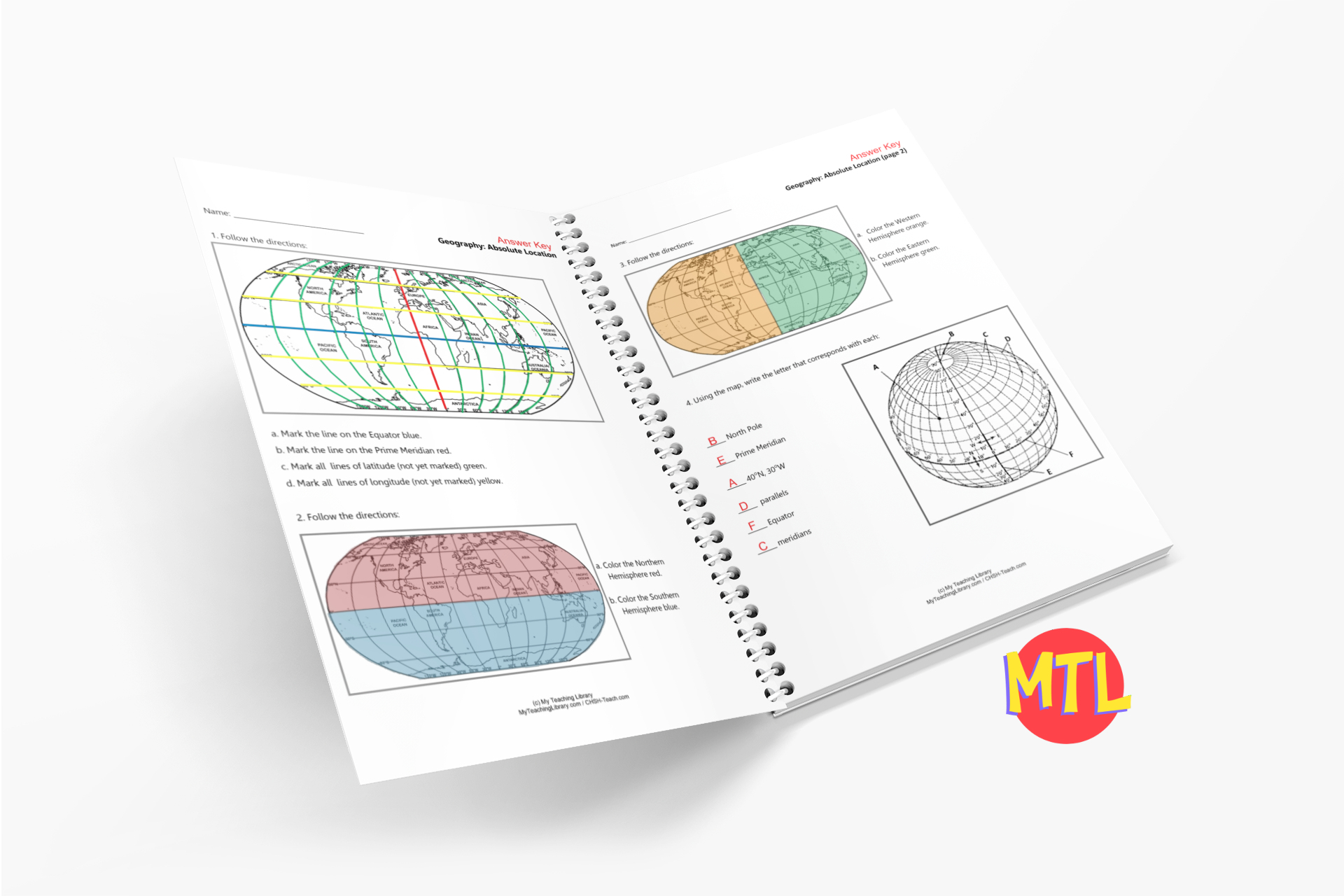
- lines of latitude
- lines of longitude
- Equator
- Prime Meridian
- parallel
- meridian
- Eastern Hemisphere
- Western Hemisphere
- Northern Hemisphere
- Southern Hemisphere
$3.00
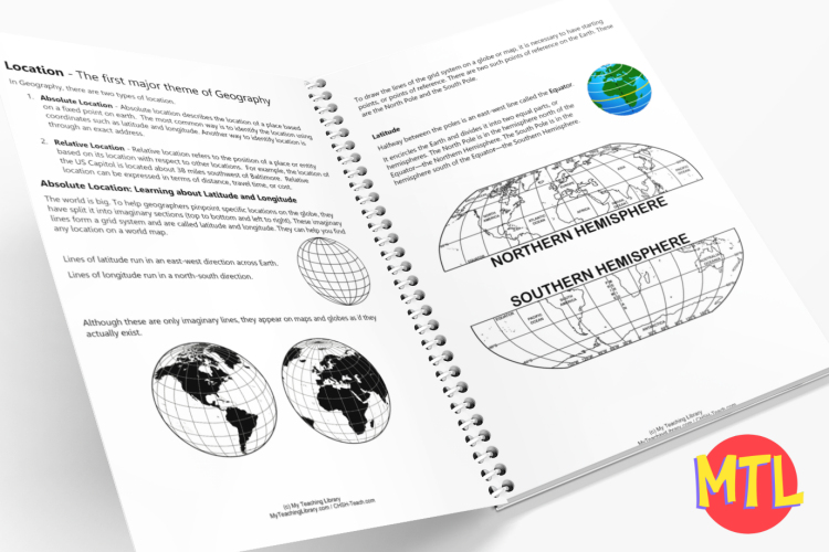
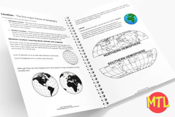
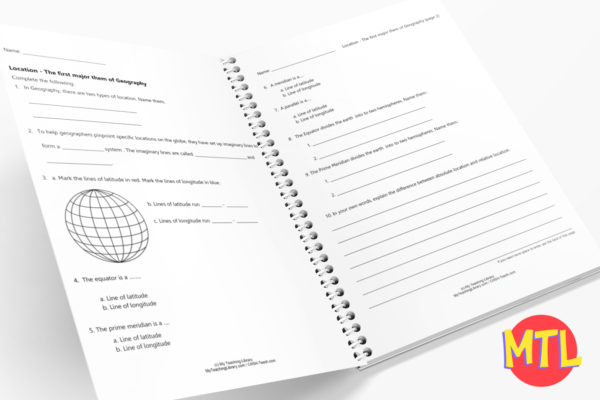
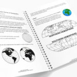
There are 5 major themes of Geography: Location, Place, Human/Environment Interaction, Movement, and Regions. This unit specifically teaches about location.
Students will learn about two types of location: absolute and relative location. In this process, they will learn about the lines of latitude and longitude, the northern, southern, eastern and western hemispheres and more.
Includes:
Vocabulary covered in the unit:
Only logged in customers who have purchased this product may leave a review.
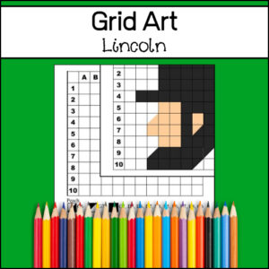
Grid art is a terrific way to practice using coordinates (A1) (D8) which is an important skill to master. Coordinates are a set of values that show an exact position which is used when graphing (Math) and reading maps (Geography). Your students will enjoy discovering the unknown, mystery picture…which happens to be Abraham Lincoln!

Want to create a space in your classroom for students to be inspired to write? Here are the materials to create an easy writing center!
Includes:

Why did the Pilgrims leave England? Where did they move before crossing the Atlantic? What did they bring with them when coming to the New World? What is the name of the ship (not the Mayflower) that also brought pilgrims to Virginia? Why did the Wampanoag attach the colonists?
Find answers to these questions and many more with the Pilgrim Fact Cards. Also included: A fun crossword puzzle!
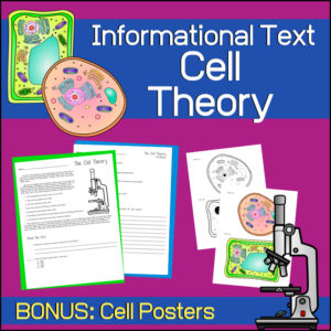
A great introductory lesson on Cell Theory for your Science students. The text will teach students about the contributions of scientists Robert Hooke, Matthias Schleiden, Theodor Schwann and Rudolf Virchow. It lists the 3 basics of Cell Theory as well as the 3 ‘modern’ ideas that have been added to Cell Theory.
Reviews
There are no reviews yet.