


Only logged in customers who have purchased this product may leave a review.
Products
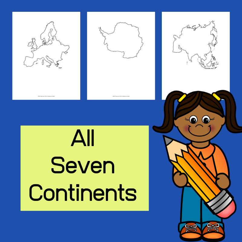
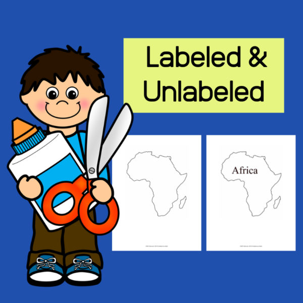
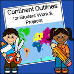
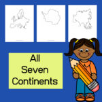
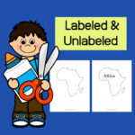
Continent Outlines for Student Work and Projects
$3.00
This resource, Continent Outlines for Student Work and Projects, contains 14 pages of continent outlines (7 labeled, 7 unlabeled). This is not clipart but ready to use outlines, just print and give to students to use however they need to!
Related products
-
 $5.00Add to Cart
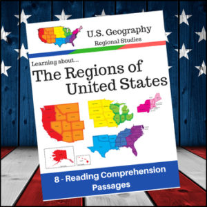
Help students expand their understanding of the different regions of the United States while learning about USA’s climate, geography, history, economy and culture.
Included sections (text and comprehension questions):
- 1. Regions of the United States
- 2. The Northeast and Midwest Regions
- 3. The South and West Regions
- 4. Learning More about the New England Subregion of the Northeast
- 5. Learning more about the Middle Atlantic Subregion of the Northeast
- 6. Learning more about the South
- 7. Learning more about the Midwest
- 8. Learning more about the West Region of the U.S
-
$4.50Add to Cart
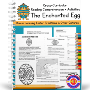
A cross-curricular (Reading/Language Arts – Math – Geography – Writing – Art) resource that students will enjoy, specifically in the Spring just before Easter. The unit begins with a fictional story called, “The Enchanted Egg” The story begins as a boy named, Neil is visiting an art museum with his parents and for the first time sees a Fabergé egg. It is a fun, delightful story as Neil ‘blacks out’ and ends up in 1910 Russia! Along the way, he learns about Easter traditions in Russia, France, Austria, Italy, Bermuda and other countries!
Includes the following activities for students to complete after reading:
1. Reading comprehension (short answer)
2. Math word problems
3. Synonyms for the following words: lightheaded, squabble, scintillate, intricate, enchanting, banquet, bejeweled, mystified, encrust, trelliswork, mourning, figurine
4. Timed writing with 9 given prompts (example prompt: Imagine that you are a craftsman at the Fabergé company and have to make a beautiful egg for the Tsar. Write about it!)
5. Story vocabulary (sentence writing)
6. Geography: Europe – map work
7. Art
8. ColoringAnswer keys provided
-
$3.00Add to Cart
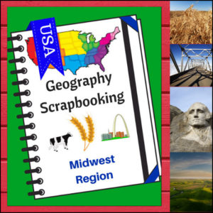
🌽 Bring the “Heartland” to life with this creative, hands-on geography resource! As your students explore the Midwest region, these scrapbooking pages provide a structured yet artistic way for them to document their discoveries. From the Great Lakes to the rolling prairies, students will transition from passive readers to active explorers as they curate their own regional “travel log.”
This 5-page set is designed to be a flexible companion to any geography curriculum, allowing students to combine factual research with personal expression.
🧠 The “How” and “Why” (Educational Benefits)
Why choose scrapbooking for geography? It’s all about engaging the whole learner:
- Visual & Kinetic Memory: By drawing or searching for pictures to paste, students create strong visual anchors for geographical concepts like landforms and landmarks. 🎨
- Synthesized Writing: Writing “short sentences” requires students to summarize what they’ve learned, which is a higher-level thinking skill than simply copying definitions. ✍️
- Student Agency: The “Personal Opinion” section empowers students to connect with the material on a human level—deciding for themselves what makes a location worth visiting. 💭
- Multi-Category Mastery: These pages ensure students don’t just learn “where” a place is, but “what” it is, covering: Climate, Landforms, Water, Natural Resources, Landmarks, and Culture. 🚜🏗️
🛠️ Ways to Use These Pages in Your Classroom
- The “Midwest Research” Project: Have students use “Regions of the U.S. – Midwest Region | Informational Text and Worksheets”, library books or safe search engines to find the facts needed to “fill their scrapbook” independently. 🔍
- A Creative Unit Wrap-Up: After finishing a unit on the Midwest, use these pages as a fun alternative to a traditional test to assess what information stuck.
- Travel Journaling: Pretend the lesson time is a time to go on a cross-country road trip. Each day, “stop” in the Midwest and have students update their scrapbooks with what they “saw.” 🚗💨
- Collaborative Portfolios: Collect the pages over the course of the year as students study every region, eventually binding them into a complete “Tour of the USA” book. 📁
📝 What’s Included:
- 5 Creative Scrapbooking Pages: Specifically tailored to the Midwest region.
- Guided Prompts: Dedicated sections for drawing/pasting and writing about climate, resources, landmarks, and more.
- Map Integration: Practice naming the states within the Heartland.
- Personal Reflection: A “Where to Visit” section to spark imagination and travel dreams.
Pro Tip: This set is designed to pair perfectly with Regions of the U.S. – Midwest Region | Informational Text and Worksheets for a comprehensive, ready-to-go geography unit!
🚀 Start the Heartland Adventure!
Turn geography into a keepsake! Download the Midwest Scrapbooking Pages today and give your students a creative way to master the map!
⭐ This product is included in a $$$ SAVING BUNDLE: Regions of the U.S.A. | Geography Bundle
-
$4.00Add to Cart
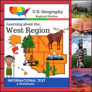
🏔️ From the volcanic peaks of Hawaii and the glaciers of Alaska to the sun-drenched deserts of the Southwest, the West Region is a land of extremes! This 15-page geography resource provides a structured, “textbook-style” exploration of the 13 states that make up this diverse region.
Following the U.S. Census Bureau regional divisions, this unit covers: Alaska, Hawaii, Washington, Oregon, California, Nevada, Idaho, Montana, Wyoming, Utah, Colorado, Arizona, and New Mexico.
🧠 The “How” and “Why” (Educational Benefits)
Why choose this unit for your geography curriculum? It’s designed to help students master complex information through high-interest content:
- Standardized & Accurate: By using the U.S. Census Bureau definitions, you ensure your students are learning the geographical groupings most commonly used in official data and advanced studies. ✅
- Holistic Exploration: We go beyond “just a map.” Students explore the region through six vital categories: Land & Water, Climate, Products & Resources, Landmarks, Culture, and Food. 🌋🍍
- Critical Thinking & Vocabulary: The category-specific questions and “State Name Unscramble” provide a mix of reading comprehension and fun cognitive puzzles. 🧩
🛠️ Ways to Use
- The Foundation of a Unit: Use the informational text as your primary reading material for a comprehensive study of the West. Its clear, concise style is perfect for independent or group/family reading. 📖
- High-Value Plans: With the text, worksheets, and full answer keys included, this is a perfect “ready-to-print” and use resource. 🍎
- Interactive Discussion: Use the “Culture and Food” sections to spark a conversation about how the West’s diverse environment influences what people eat and how they live! 🌮🏔️
📝 What’s Inside This 15-Page Resource:
- Informational Text: Detailed “textbook-style” pages on the geography and life of the West.
- Comprehensive Worksheets: Dedicated questions for every regional topic.
- State Name Unscramble: A fun way to reinforce state identification and spelling.
- Full Answer Keys: For quick, hassle-free grading. ✅
Pro Tip: For the ultimate hands-on experience, pair this unit with the US Geography – West Scrapbooking Pages! Students can use the facts they learn here to create a beautiful, illustrated travel journal of the Western states.
🚀 Adventure into the West Today!
Give your students a clear, professional, and engaging path to mastering U.S. Geography. Download the Regions of the U.S. – West Region unit and watch your young explorers discover the wonders of the American West!⭐ This product is included in a $$$ SAVING BUNDLE: Regions of the U.S.A. | Geography Bundle
Reviews
There are no reviews yet.