Category: Geography
Showing 41–54 of 54 resultsSorted by latest
-
 $4.50Buy Now
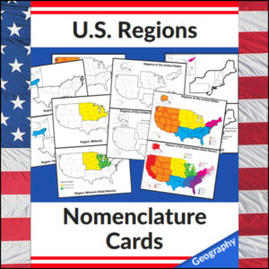
This set of U.S. Regions – Geography – Nomenclature cards consists of 20 cards. Use in any study of Geography of the United States, individual state studies, in centers, as handouts, on displays, etc! This set has the U.S. divided into *4 regions as defined by the U.S. Census Bureau
Cards in this set:- Regions of the United States in color with coded key (4 regions*)
- Regions of the United States in color with coded key with state names
- Regions of the United States in b/w and separated
- Regions of the United States in b/w and separated with state names
- Northeast Region (in color displayed on b/w full U.S. map)
- Northeast Region with state names (in color displayed on b/w full U.S. map)
- Northeast Region b/w standing alone (with small insert of region in color displayed on b/w full U.S. map)
- Northeast Region b/w standing alone with state names (in color displayed on b/w full U.S. map)
- Midwest Region (in color displayed on b/w full U.S. map)
- Midwest Region with state names (in color displayed on b/w full U.S. map)
- Midwest Region b/w standing alone (with small insert of region in color displayed on b/w full U.S. map)
- Midwest Region b/w standing alone with state names (in color displayed on b/w full U.S. map)
- South Region (in color displayed on b/w full U.S. map)
- South Region with state names (in color displayed on b/w full U.S. map)
- South Region b/w standing alone (with small insert of region in color displayed on b/w full U.S. map)
- South Region b/w standing alone with state names (in color displayed on b/w full U.S. map)
- West Region (in color displayed on b/w full U.S. map)
- West Region with state names (in color displayed on b/w full U.S. map)
- West Region b/w standing alone (with small insert of region in color displayed on b/w full U.S. map)
- West Region b/w standing alone with state names (in color displayed on b/w full U.S. map)
⭐ This product is included in a $$$ SAVING BUNDLE: Regions of the U.S.A. | Geography Bundle
-
 $2.50Buy Now
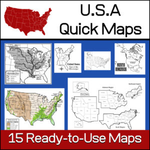
15 ready-to-use maps of the United States. Use for class projects, to create lessons or presentations.
Non-commercial use only.Includes:
– 2 maps showing the US within North America
– US maps (with states names and unnamed)
– US regional maps (with states names and unnamed)
– US east of the Mississippi (with states names and unnamed)
– US west of the Mississippi (with states names and unnamed)
– Physical Maps of the US (color and b/w)
– The Mississippi River with tributaries (states named) -
 $1.50Buy Now
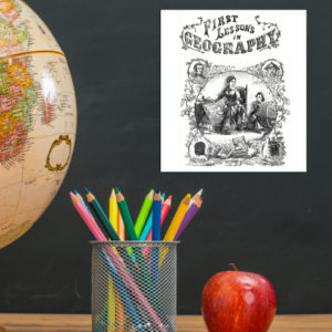
This is a downloadable copy of the book. (74 pages)
About the book: This book was written in 1856 is written in a question – answer format:
Q. What is Geography?
A. A description of the Earth’s surfact
Q. What is the Earth
A. The planet or body on which we live.
Q. What is a Continent?
A. The largest division of land.Because it was written in the mid 19th century, all of the maps are outdated…However, this can lend itself to great teaching lessons! Compare and contrast the old with the new. Research what events in history led up to the changes from then to now, etc.!
-
 $1.25Buy Now
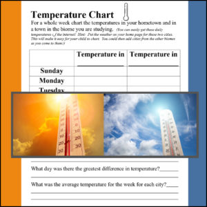
A biome is a large geographical area that contains distinct plant and animal groups which are adapted to live in that environment. There can be many different habitats in a biome. Some major biomes are tundra, taiga, grasslands, deciduous forest, fresh water, desert, alpine, rainforest and ocean. When studying a specific biome, use this temperature comparison chart to record the temperature in the student’s hometown and the biome of study for a week! (Use again and again with each biome studied)
Science meets Geography
-
 $2.00Buy Now
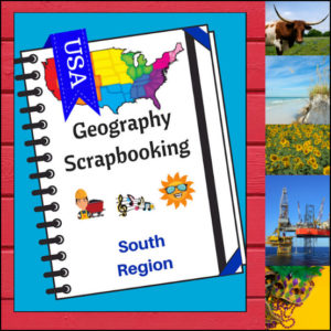
This U.S. geography resource provides students with an interactive project to record what they have various aspects of the South. Students will draw (or paste) pictures and write a few short sentences about climate, landforms, water, natural resources, landmarks and culture. Students will also be asked to name the states of the region and give a personal opinion about a place they would most like to visit in the region. There are 5 scrapbooking pages for student use.
Because the United States can be divided up into different regions, I’ve designed this resource to follow the regions as defined by the U.S. Census Bureau. The resource shows the states in the Midwest as being Alabama, Arkansas, Delaware, Florida, Georgia, Kentucky, Louisiana, Maryland, Mississippi, North Carolina, Oklahoma, South Carolina, Tennessee, Texas, Virginia and West Virginia.
Use as a stand alone product or use with My Teaching Library’s Regions of the U.S. – South Region – Informational Text and Worksheets
⭐ This product is included in a $$$ SAVING BUNDLE: Regions of the U.S.A. | Geography Bundle
-
 $2.50Buy Now
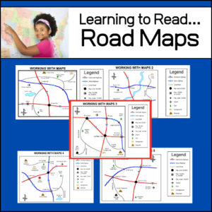
An important life skill is learning how to read maps! This resource provides 5 easy to read road maps. For each map, students will practice using the legend and answer 12-15 questions. Students will answer a total of 71 questions – Answer Keys provided.
-
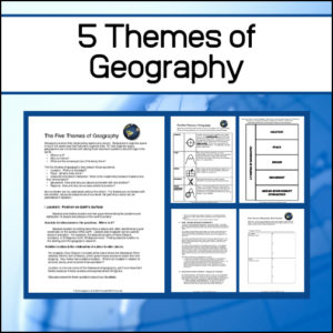 $3.50Buy Now
In geography, students should learn the five themes of geography. Learning these themes will help students begin to think like geographers…organizing space (i.e. ‘the world’) in much the same way as historians organize time. This resource will teach students the five themes plus gives them the opportunity to practice using them!
Includes:
– 4.5 pages of informational text explaining the themes in detail
– A notebooking template and explanation strips for students to use as a study aid
– An activity that can be used again and again so students can put into practice what they have learned -
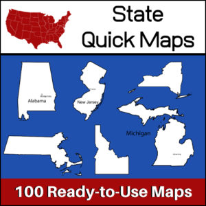 $5.00Buy Now
100 U.S. State outline maps – 2 maps for each state on one page:
- – Completely blank outline map
- – An outline with the state name and capital
Maps can be used for projects, bulletin boards, lesson plans and presentations.
Non-commercial use only. -
 $3.00Buy Now
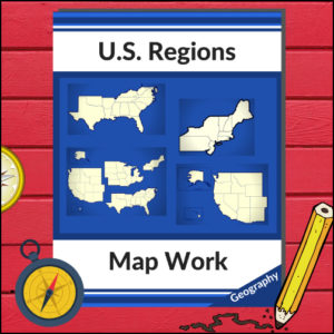
This resource will help your students learn more about U.S. Geography and the 4 main regions (as defined by the U.S. Census Bureau). Students will be working with maps of the entire United States as well as those of each region as they identify states, capitols, national parks, mountain ranges and points of interest! Great for any Social Studies class studying the U.S.A.!
-
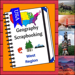 $2.00Buy Now
A hands-on, interactive geography product for student who are studying U.S. geography, specifically the western region. As students study the states of the west they can draw (or paste) pictures and write a few short sentences about climate, landforms, water, natural resources, landmarks and culture. Students will also be asked to name the states of the region and give a personal opinion about a place they would most like to visit in the region. There are 5 scrapbooking / notebooking pages for student use. Perfect to use with My Teaching Library’s Regions of the U.S. – West Region – Informational Text and Worksheets
⭐ This product is included in a $$$ SAVING BUNDLE: Regions of the U.S.A. | Geography Bundle
-
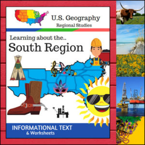 $3.50Buy Now
This Regions of the U.S. Geography resource is centered on the South Region and contains textbook style informational text and related student worksheets with answer keys. Students will enjoy learning about this region studying the categories of Land and Water, Climate, Products and Natural Resources, Landmarks, Culture and Food. The informational text worksheets begin with an anticipation activity section followed by questions that students will answer about each category. The last is a fun ‘unscramble’ the state names worksheet. (Pages: 15)
Because the United States can be divided up into different regions, I’ve designed this resource to follow the regions as defined by the U.S. Census Bureau. The resource shows the states in the Midwest as being Alabama, Arkansas, Delaware, Florida, Georgia, Kentucky, Louisiana, Maryland, Mississippi, North Carolina, Oklahoma, South Carolina, Tennessee, Texas, Virginia and West Virginia
⭐ This product is included in a $$$ SAVING BUNDLE: Regions of the U.S.A. | Geography Bundle
-
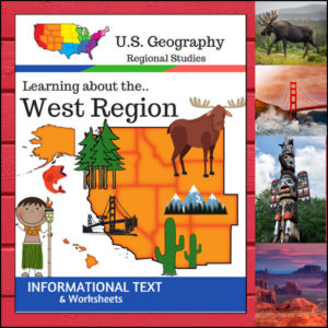 $3.50Buy Now
This U.S. Geography resource is centered on the West Region and contains textbook style informational text, worksheets and answer keys. Students will enjoy learning about this region studying the categories of Land and Water, Climate, Products and Natural Resources, Landmarks, Culture and Food. The informational text worksheets begin with an anticipation activity section followed by questions that students will answer about each category. The last is a fun ‘unscramble’ the state names worksheet. (Pages: 15)
⭐ This product is included in a $$$ SAVING BUNDLE: Regions of the U.S.A. | Geography Bundle
-
 $3.50Buy Now
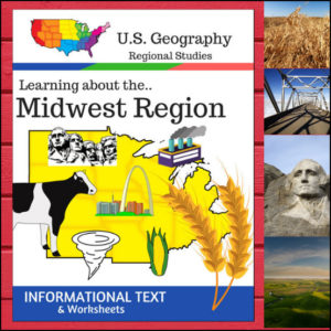
This Regions of the U.S. Geography resource is centered on the Midwest Region and contains textbook style informational text and related student worksheets with answer keys. Students will enjoy learning about this region studying the categories of Land and Water, Climate, Products and Natural Resources, Landmarks, Culture and Food.
Because the United States can be divided up into different regions, I’ve designed this resource to follow the regions as defined by the U.S. Census Bureau. The resource shows the states in the Midwest as being North Dakota, South Dakota, Nebraska, Kansas, Minnesota, Iowa, Missouri, Wisconsin, Illinois, Indiana, Michigan, Ohio
⭐ This product is included in a $$$ SAVING BUNDLE: Regions of the U.S.A. | Geography Bundle
-
 $5.00Buy Now
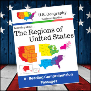
Help students expand their understanding of the different regions of the United States while learning about USA’s climate, geography, history, economy and culture.
Included sections (text and comprehension questions):
- 1. Regions of the United States
- 2. The Northeast and Midwest Regions
- 3. The South and West Regions
- 4. Learning More about the New England Subregion of the Northeast
- 5. Learning more about the Middle Atlantic Subregion of the Northeast
- 6. Learning more about the South
- 7. Learning more about the Midwest
- 8. Learning more about the West Region of the U.S