Showing 21–40 of 48 results
-
 $3.00Buy Now
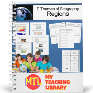
There are 5 major themes of Geography: Location, Place, Human/Environment Interaction, Movement, and Regions. This unit specifically teaches about Region.
In Geography, region is an area on earth’s surface that is defined by certain unifying characteristics and can be categorized into three different regional ‘types’. In this unit study, students will learn about three unifying characteristics:
- – Human Characteristics
- – Physical Characteristics
- – Cultural Characteristics
They will also learn about the three different region types:
- – Formal
- – Functional
- – Perceptual
Includes:
- – 5 informational text pages
- – Vocabulary cards
- – 5 Student worksheet pages
- – Answer Keys
-
$3.00Buy Now
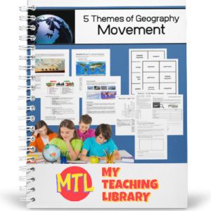
There are 5 major themes of Geography: Location, Place, Human/Environment Interaction, Movement, and Regions. This unit specifically teaches about Movement
In Geography, movement describes the ways people, goods, information and ideas move from one place to another. In this unit, students will learn about each, specifically about ‘why people move‘, the different types of migration, ‘how goods move‘, how the movement of information and ideas have changed and globalization.
Includes:
– 5 pgs of informational text
– Vocabulary Cards
– 5 Student worksheet pages
– 1 Crossword puzzle
– Answer Keys -
$3.00Buy Now
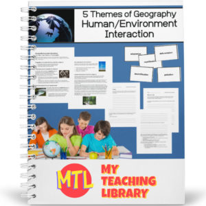
There are 5 major themes of Geography: Location, Place, Human/Environment Interaction, Movement, and Regions. This unit specifically teaches about Human Environment Interaction.
People adapt to the environment in which they live. The clothes they wear, the food the eat, what they farm (or if they farm), etc., all depends on where they live. They also depend on the environment for basic needs and change it along the way. This unit will teach students about the interactions that take place between people and the environment in which they live.
Includes:
- – 3 pages of instructional text
- – Vocabulary cards
- – 8 student worksheet pages + an interview assignment
- – Answer keys
-
$3.50Buy Now
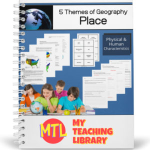
There are 5 major themes of Geography: Location, Place, Human/Environment Interaction, Movement, and Regions. This unit specifically teaches about place.
In Geography, place describes how areas are alike and different. Students will learn about two ways ‘place’ is categorized: physical characteristics and human characteristics. Physical characteristics discussed include: landforms, bodies of water, climate, soil, vegetation and animal life. Human characteristics discussed include: land use, population, language, religion, architecture and political systems.
Includes:
- – 8 pages of instructional text
- – Vocabulary cards
- – 4 student worksheet pages + essay questions which can be assigned or discussed
- – Answer keys
-
$3.00Buy Now
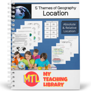
There are 5 major themes of Geography: Location, Place, Human/Environment Interaction, Movement, and Regions. This unit specifically teaches about location.
Students will learn about two types of location: absolute and relative location. In this process, they will learn about the lines of latitude and longitude, the northern, southern, eastern and western hemispheres and more.
Includes:
- – 6 pages of instructional text
- – Vocabulary cards
- – 5 student worksheet pages
- – Answer keys
-
$1.50Buy Now
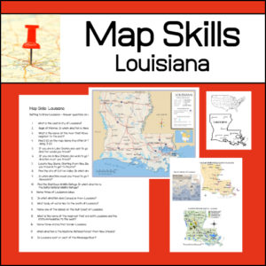
Learning to read different types of maps is a vital skill for students to learn and practice. With this resource, students will be given several maps and questions to answer using the maps. Maps and questions all center around the state of Louisiana.
-
$1.25Buy Now
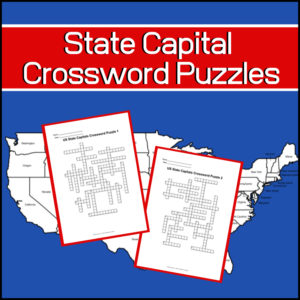
Studying the capitals of the United States? Want a couple fun, educational crossword puzzles for your students? Here they are!
Includes: 2 Crossword puzzles.
Each puzzle comes with 2 ‘clue’ pages. One without possible answers and one with a word bank from which to choose. You decide which one to give students!Answer keys provided.
-
$3.00Buy Now
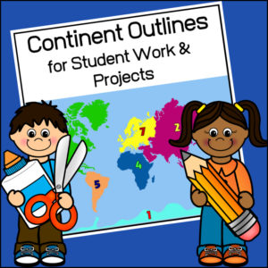
This resource, Continent Outlines for Student Work and Projects, contains 14 pages of continent outlines (7 labeled, 7 unlabeled). This is not clipart but ready to use outlines, just print and give to students to use however they need to!
-
$2.00Buy Now
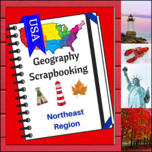
As students study the Northeast region of the United States, have them complete these scrapbook activities to show what they are learning! Students will draw (or paste) pictures and write a few short sentences about climate, landforms, water, natural resources, landmarks and culture. Students will also be asked to name the states of the region and give a personal opinion about a place they would most like to visit in the region. There are 5 scrapbooking pages for student use.
Perfect to use with My Teaching Library’s Regions of the U.S. – Northeast Region | Informational Text and Worksheets
-
$2.00Buy Now
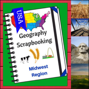
As students study the Midwest region of the United States, have them complete these scrapbook activities. Students will draw (or paste) pictures and write a few short sentences about climate, landforms, water, natural resources, landmarks and culture. Students will also be asked to name the states of the region and give a personal opinion about a place they would most like to visit in the region. There are 5 scrapbooking pages for student use.
You can use these pages with your own curriculum or research to find the information to fill in the scrapbook.
-
$3.50Buy Now
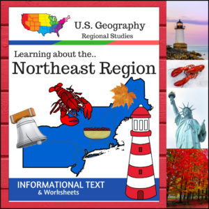
This Regions of the U.S. Geography resource is centered on the Northeast Region and contains textbook style informational text and related student worksheets with answer keys. Students will enjoy learning about the northeast region studying the categories of Land and Water, Climate, Products and Natural Resources, Landmarks, Culture and Food.
The informational text worksheets begin with an anticipation activity section followed by questions that students will answer about each category. The last is a fun ‘unscramble’ the state names worksheet. (Pages: 12)
-
 $8.00Buy Now
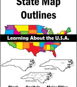
150 maps included in this download!
Each state has 3 pages / maps:
* Outline of the state
* Map showing the capital
* Map showing the major cities -
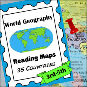
$8.00Buy NowHelp students master an important life skill, map reading, with this geography resource! It includes maps of 35 countries from around the world and students will practice identifying direction, using a scale of miles/km, reading & using a map key, finding places and determining specific information from given information, calculate distance and more!
This product is designed for 3th-5th grades but can be a good edition for 6th-8th graders who need extra practicing reading maps! -
$3.99Buy Now
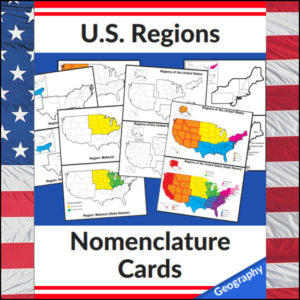
This set of U.S. Regions – Geography – Nomenclature cards consists of 20 cards – See description below for details for each card.
Use in any study of Geography of the United States, individual state studies, in centers, as handouts, on displays, etc! This set has the U.S. divided into *4 regions as defined by the U.S. Census Bureau
-
$2.50Buy Now
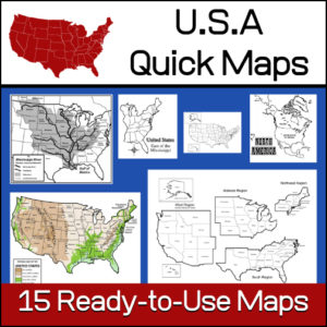
15 ready-to-use maps of the United States. Use for class projects, to create lessons or presentations.
Non-commercial use only.Includes:
– 2 maps showing the US within North America
– US maps (with states names and unnamed)
– US regional maps (with states names and unnamed)
– US east of the Mississippi (with states names and unnamed)
– US west of the Mississippi (with states names and unnamed)
– Physical Maps of the US (color and b/w)
– The Mississippi River with tributaries (states named) -
$1.50Buy Now
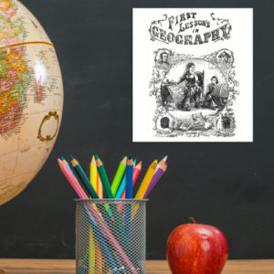
This is a downloadable copy of the book. (74 pages)
About the book: This book was written in 1856 is written in a question – answer format:
Q. What is Geography?
A. A description of the Earth’s surfact
Q. What is the Earth
A. The planet or body on which we live.
Q. What is a Continent?
A. The largest division of land.Because it was written in the mid 19th century, all of the maps are outdated…However, this can lend itself to great teaching lessons! Compare and contrast the old with the new. Research what events in history led up to the changes from then to now, etc.!
-
$1.25Buy Now
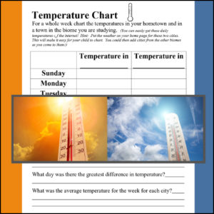
A biome is a large geographical area that contains distinct plant and animal groups which are adapted to live in that environment. There can be many different habitats in a biome. Some major biomes are tundra, taiga, grasslands, deciduous forest, fresh water, desert, alpine, rainforest and ocean. When studying a specific biome, use this temperature comparison chart to record the temperature in the student’s hometown and the biome of study for a week! (Use again and again with each biome studied)
Science meets Geography
-
$2.00Buy Now
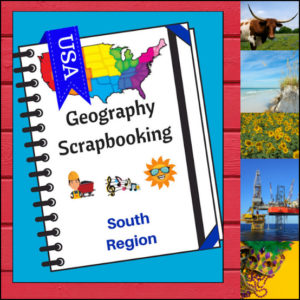
This U.S. geography resource provides students with an interactive project to record what they have various aspects of the South. Students will draw (or paste) pictures and write a few short sentences about climate, landforms, water, natural resources, landmarks and culture. Students will also be asked to name the states of the region and give a personal opinion about a place they would most like to visit in the region. There are 5 scrapbooking pages for student use.
Because the United States can be divided up into different regions, I’ve designed this resource to follow the regions as defined by the U.S. Census Bureau. The resource shows the states in the Midwest as being Alabama, Arkansas, Delaware, Florida, Georgia, Kentucky, Louisiana, Maryland, Mississippi, North Carolina, Oklahoma, South Carolina, Tennessee, Texas, Virginia and West Virginia.
Use as a stand alone product or use with My Teaching Library’s Regions of the U.S. – South Region – Informational Text and Worksheets
-
$2.50Buy Now
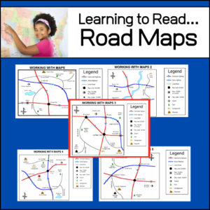
An important life skill is learning how to read maps! This resource provides 5 easy to read road maps. For each map, students will practice using the legend and answer 12-15 questions. Students will answer a total of 71 questions – Answer Keys provided.
&url=https://myteachinglibrary.com/product/u-s-state-map-outlines-usa-geography/&media=https://myteachinglibrary.com/wp-content/uploads/2019/08/wy-459-f.jpg)